
The Geography of Bhutan: A Journey from Tropics to High Peaks
Bhutan, often called the “Last Shangri-La,” offers a landscape that is as dramatic as it is spiritual.
Nestled in the heart of the Eastern Himalayas, Bhutan is a land of profound contrasts. Within a short distance of just 150km (93 miles) from south to north, the elevation sky-rockets from near sea level to over 7,500 meters.
Traveling in Bhutan involves frequent changes in elevation. Most tourist valleys sit between 1,200m and 3,000m. While altitude sickness is rare in the main towns, we recommend a slow pace for your first 48 hours to acclimatize to the “thin” mountain air.
Western Bhutan
It is the cultural and political heart of the Kingdom. It is home to the country’s only international airport (Paro), the capital city (Thimphu), and some of the most iconic landscapes that define the Bhutanese identity.
The region is characterized by deep, fertile valleys, ancient fortresses known as dzongs, and a climate that ranges from the crisp alpine air of the high passes to the subtropical warmth of the lower valleys.
1. Paro – The Gateway
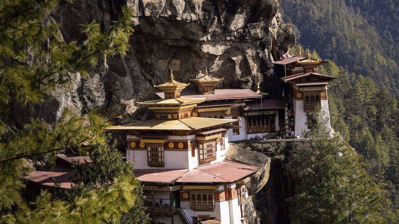
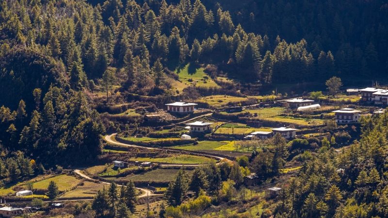
Paro is often the first-place travelers fall in love with, as it is home to Bhutan’s only international airport. It is a wide, beautiful valley filled with golden rice paddies, willow-lined rivers, and some of the most sacred sites in the Himalayas with the Valley Floor Elevation around 2,200m (7,218 ft).
2. Thimphu – The Modern Capital
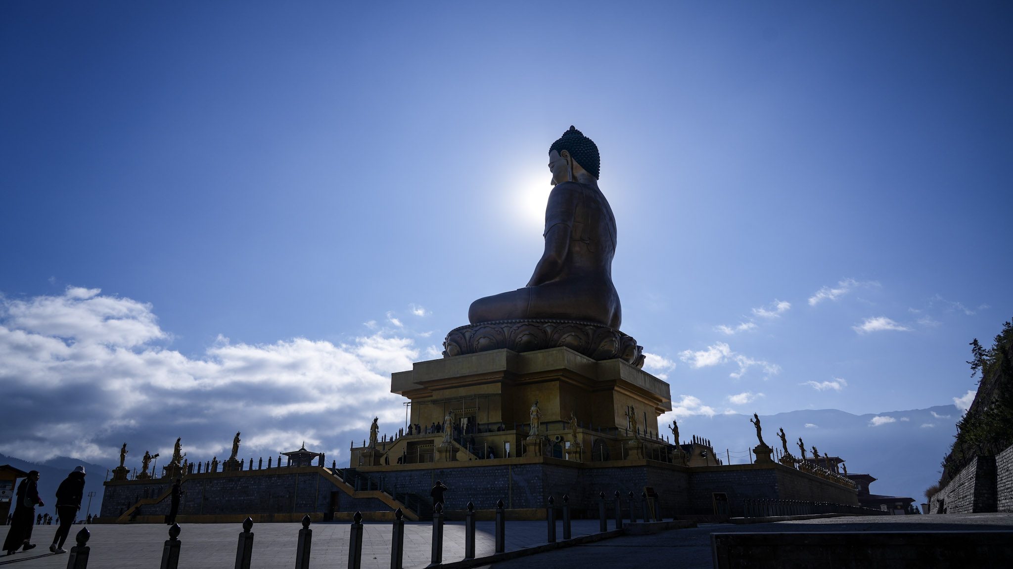
The only capital city in the world without traffic lights, Thimphu is where tradition meets the 21st century. While Paro is the gateway, Thimphu is where the heartbeat of modern Bhutan is most felt a unique city where traditional mud-rammed houses stand alongside modern cafes, and monks walking with smartphones are a common sight. The city sits at roughly 2,330m (7,644 ft), making it one of the highest capital cities in the world.
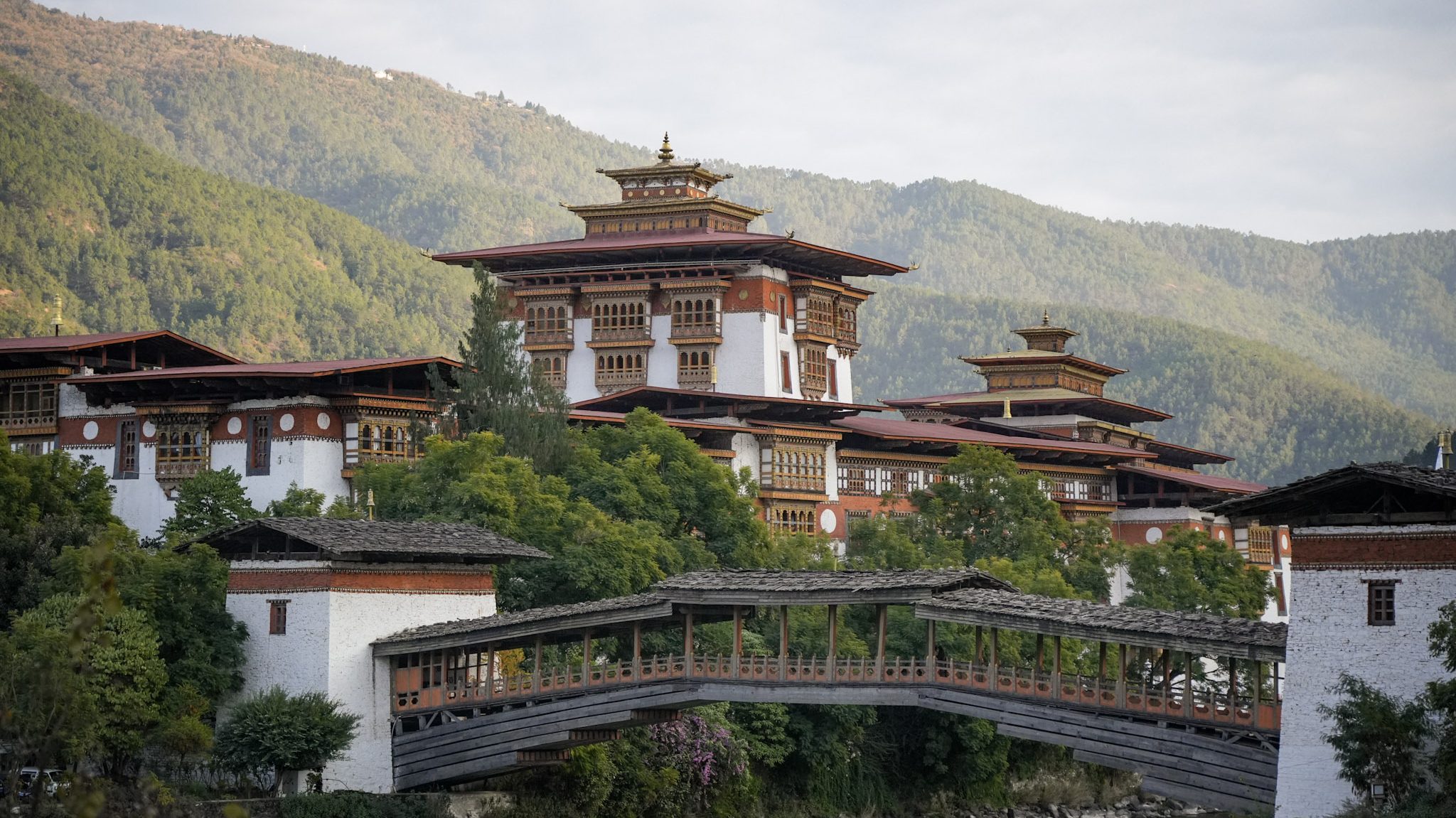
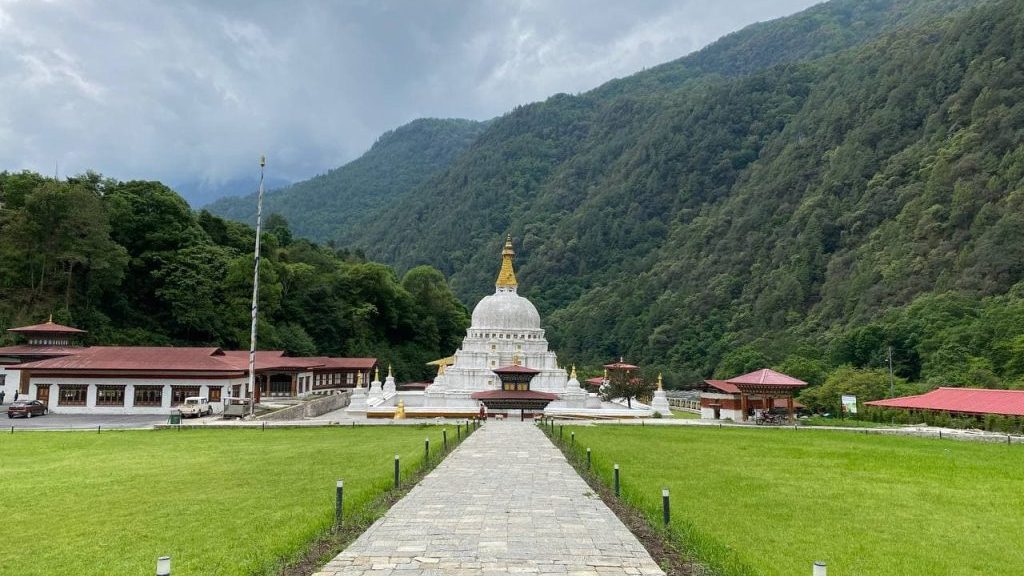
3. Punakha – The Ancient Capital
Punakha is the ancient capital of Bhutan and, for many, the most beautiful valley in the country. Located at a lower elevation than Thimphu (1,200 meters), it enjoys a subtropical climate, meaning it stays warm even in winter and is lush with rice paddies, orange groves, and blooming jacaranda trees.
4. Haa Valley – The Hidden Gem
Haa District is the “Hidden Gem” of Bhutan. it is one of the smallest and least-visited districts in the western part of the country. Because it was only opened to foreign tourists in 2002. it is a paradise for those who prefer silence, hiking, and “untouched” cultural experiences. Since it is less commercialized than other districts, the activities here are deeply authentic
5. Wangdue Phodrang & Phobjikha
Wangdue Phodrang (often shortened to “Wangdi”) is one of the largest and most ecologically diverse districts in Bhutan. It is a place of dramatic contrasts, ranging from the warm, cactus-dotted river valleys of the south to the high, glacial meadows of the Phobjikha Valley (also known as Gangtey).

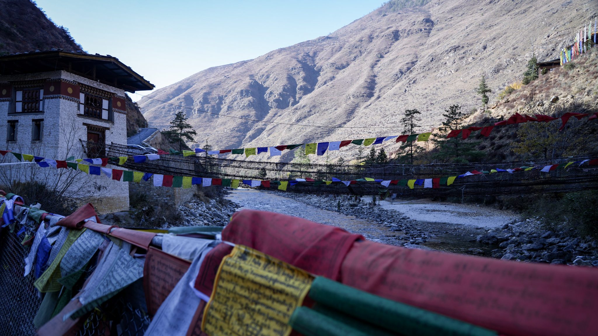
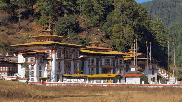
Western Bhutan is separated from the central region by the Pele La pass. One of the most scenic spots is the Dochula Pass (3,100 meters), which offers a 360-degree panoramic view of the Himalayan range and is adorned with 108 memorial chortens.
Central Bhutan
Central Bhutan is the cultural and spiritual heart of the kingdom. While the west (Paro and Thimphu) is the hub of modern governance and tourism, the center is where Bhutan’s history was written and where its deepest religious traditions are still vibrantly alive.
It primarily consists of two major districts: Trongsa and Bumthang.
1. Bumthang
Bumthang, a land of ancient legends, comprising four distinct and breathtaking valleys – Chokhor, Tang, Ura, and Chhume. Known as the most sacred region in the Kingdom, Bumthang’s name carries a poetic duality. It is whispered to mean both the “Plain of the Holy Water Vase,” describing the physical grace of its landscape, and the “Valley of Beautiful Girls.”
Whether you are seeking a profound spiritual pilgrimage or a “Swiss-style” culinary adventure, this region is Bhutan’s most diverse and fascinating destination.
2. Trongsa
Trongsa is often called the “Gateway to the East” and is perhaps the most historically significant town in Bhutan. Because of its strategic location in the center of the country, it was once the seat of power from which the royal family unified the kingdom.
The elevation varies wildly across the district, from as low as 600m in the southern subtropics to over 5,000m at the northern alpine peaks. The town is built on a steep ridge overlooking the Mangde Chhu river.
Eastern Bhutan
If Bumthang is the “spiritual heart” of Bhutan, then Eastern Bhutan is its “undiscovered jewel.” Comprising districts like Mongar, Lhuentse, Trashigang, Pema Gatshel and Trashi Yangtse, this region is famous for its raw natural beauty, intricate silk weaving, and deep-seated legends.
Eastern Bhutan is widely regarded as the birthplace of Bhutanese culture. Many of the country’s earliest settlements, dialects, and traditions originated here. It’s where Bhutan’s identity was shaped long before modern roads or tourism.
Eastern Bhutan especially Lhuentse, Trashigang, and Mongar is famous for producing the most intricate handwoven textiles in the country.
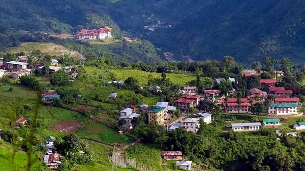
1. Lhuentse District
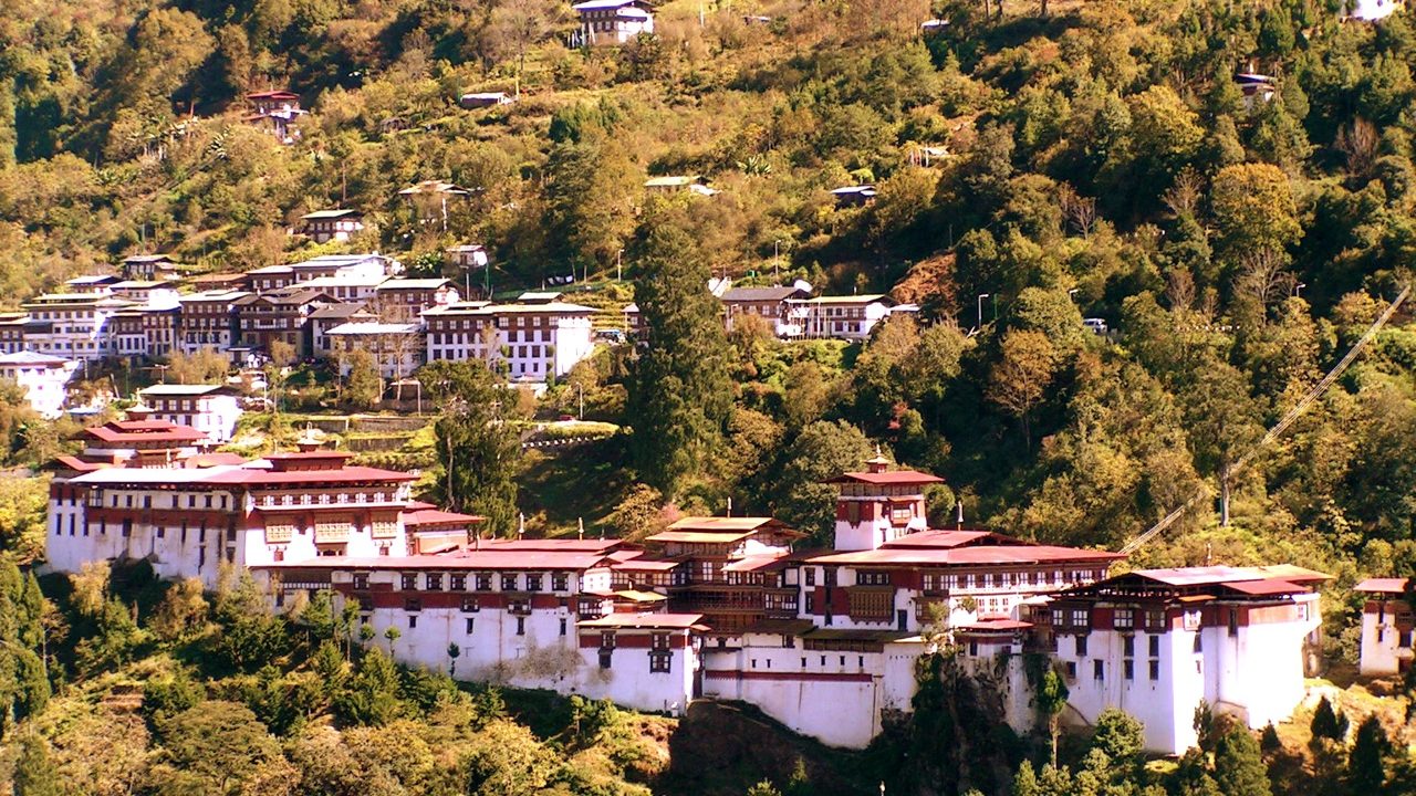
Lhuentse is the ancestral home of the Bhutanese Royal Family. The Lhuentse Dzong, perched on a cliff overlooking the Kuri Chhu river, is one of the most picturesque fortresses in the country.
Lhuentse’s geography is a dramatic mix of deep river gorges and towering cliffs with an average town elevation of Approximately 2,323m (7,621 ft).

2. Mongar District
Often called the “Gateway to the East,” Mongar marks a distinct change in the Bhutanese landscape. As you travel from the high-altitude central valleys of Bumthang, the road descends sharply into warmer, more tropical terrain, eventually leading you to the bustling hilltop town of Mongar.
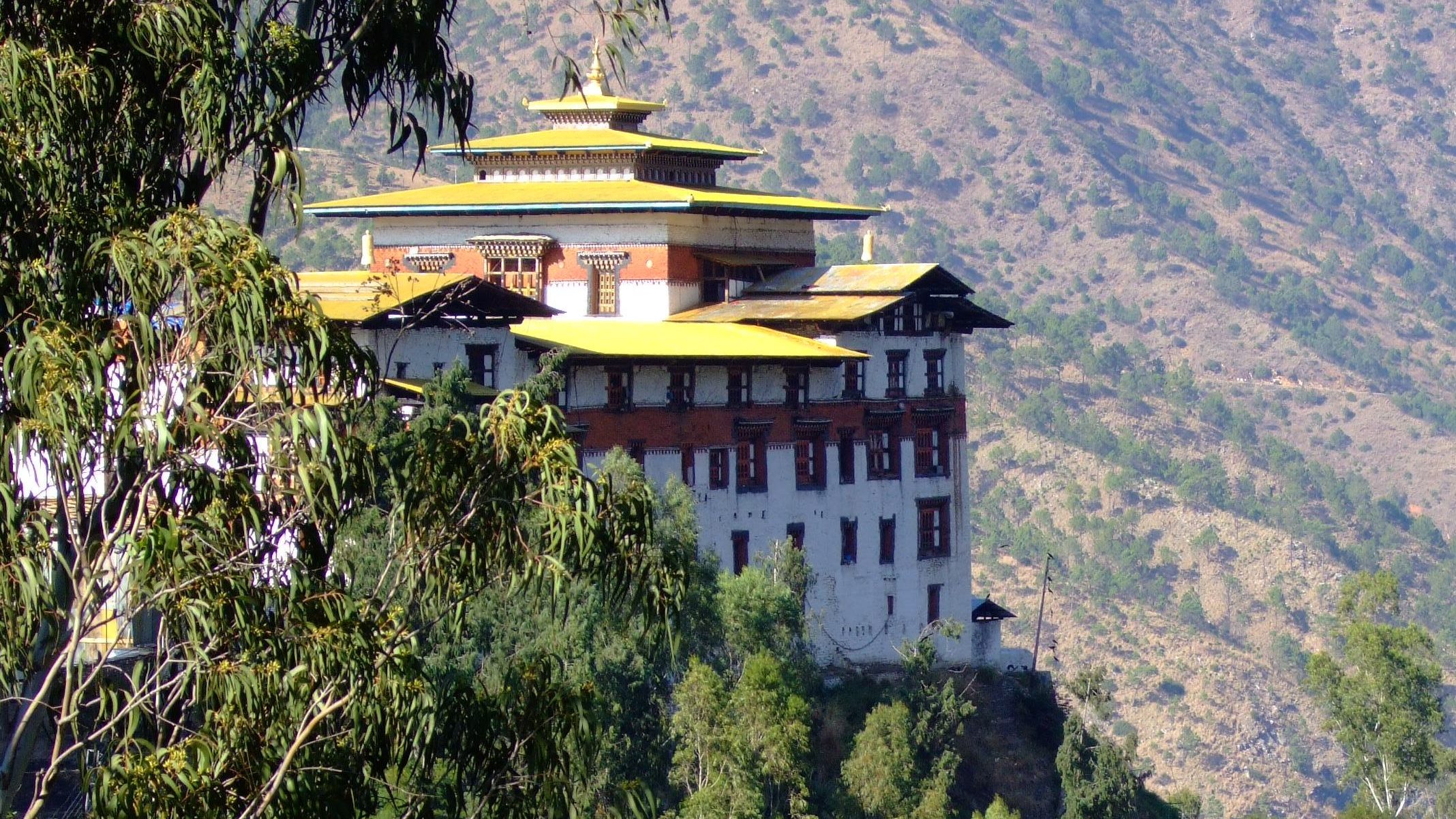
3. Trashigang District
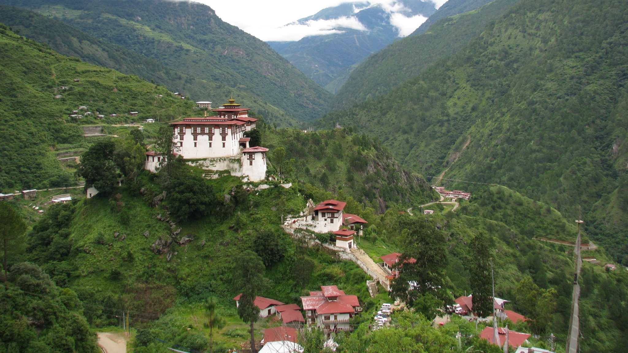
Trashigang is the largest district in Bhutan and was once the center of a busy trade route with Tibet. The Trashigang Dzong, famously known as the “Sky Fortress,” sits high above a precipitous ridge overlooking the confluence of the Drangme Chhu and Gamri Chhu rivers.
Trashigang’s landscape is defined by its extreme verticality and bougainvillea-covered houses with a town elevation of approximately 1,150m (3,770 ft).
4. Trashi Yangtse District
Trashi Yangtse is the northeasternmost district of Bhutan, established in 1992 after being carved out of Trashigang. It is a quiet, beautiful region where nature and traditional craftsmanship are the primary ways of life.
The district is characterized by lush alpine and subtropical forests, with the town itself sitting at a comfortable altitude of Approximately 1,871m (6,138 ft).
5. Pemagatshel District
Pemagatshel is often called the “Lotus Garden of Happiness” (Pema meaning Lotus, Gatshel meaning Garden). It is one of Bhutan’s most rural and culturally rich districts, famous for its soulful folk music, master artisans, and a unique local sweet that is loved across the country.
The altitude varies significantly, from 1,000m in the lower valleys to 3,500m on the higher ridges with the town elevation of 1600m (5250 ft).
Southern Bhutan
The southern regions of Bhutan are a vibrant contrast to the high-altitude north. This is the Gateway to the Kingdom, where the Himalayan foothills meet the Indian plains. It is a region of lush subtropical jungles, exotic wildlife, and a unique cultural blend of Ngalops, Sharchops, and Lhotshampas (the ethnic Nepalese-origin community).
Because it is warmer and lower in elevation, Southern Bhutan is the best place for nature safaris, bird watching, and experiencing the country’s modern economic pulse.
1. The Gateway Districts – Phuentsholing (Chukha District)
Phuentsholing is the second-largest city in Bhutan and the administrative seat of the Chukha District. Often called the “Gateway to the Kingdom,” it is a fascinating place where the lush, quiet beauty of Bhutan meets the vibrant, busy energy of India.
Unlike the high-altitude towns of the north, Phuentsholing is a modern commercial hub with a subtropical pulse with the elevation of approximately 300m( 985 ft).

2. Sarpang – Gelephu District
Gelephu is the bustling heart of the Sarpang District and is currently the most talked-about region in Bhutan. While it has long been a vital trade hub with India, it is now the site of the Gelephu Mindfulness City (GMC) – a visionary “Special Administrative Region” that aims to become a global model for sustainable, mindful living.